
A Fragile Sense of Place
Two Thames Barrier studies (each approx 11 x 8 cm unframed: gouache on card)
If not for the Thames Barrier, during periods of extreme high tide and severe weather, London would look very different.
The Royal Watercolour Society - for its Autumn exhibition 2016 - has briefed members to create artworks that explore the notion of a sense of place, specifically within the location of London. To me, a sense of place is something sensed and not usually identifiable, it's something intangible, a culmination of emotional and sensorial reactions to a physical environment to which I am connected. But taken literally, the event of physical inundation - a flood for example - can completely destroy one's sense of place within a location they [once] understood.
When a river bursts its banks, its 'wetted perimeter' is no longer where it should be. As water travels upward and outward, the map of the city changes dramatically. A rise in water level even of only a few inches can mean the difference between ground level, and the invasion of someone's house. Worryingly, the Thames Barrier has been in 'record' use in recent years (from early December 2013 to the end of February 2015, its steel gates were closed "a record-shattering 50 times, preventing the river from running riot. Previously, the barrier had closed only 124 times since it began operating in 1982" - The Guardian).
As we are witnessing ever more frequently, in locations around the world, London is not alone in being vulnerable to flooding. A storm surge generated by low pressure in the Atlantic Ocean sometimes tracks eastwards past the north of Scotland and may then be driven into the shallow waters of the North Sea. The surge tide is funnelled down the North Sea which narrows towards the English Channel and the Thames Estuary. If the storm surge coincides with a spring tide, dangerously high water levels can occur in the Thames Estuary, and if not for the Thames Barrier system, London would face a frequent and dangerous set of issues.
The threat has increased over time due to continuous rise in high water levels over the centuries and the slow 'tilting' of Britain (up in the north and west, and down in the south and east) caused by post-glacial rebound. The barrier was originally designed to protect London against a very high flood level up to the year 2030, after which the protection would decrease, whilst remaining within acceptable limits. At the time of its construction, the barrier was expected to be used 2–3 times per year. It is now being used over 7 times per year.
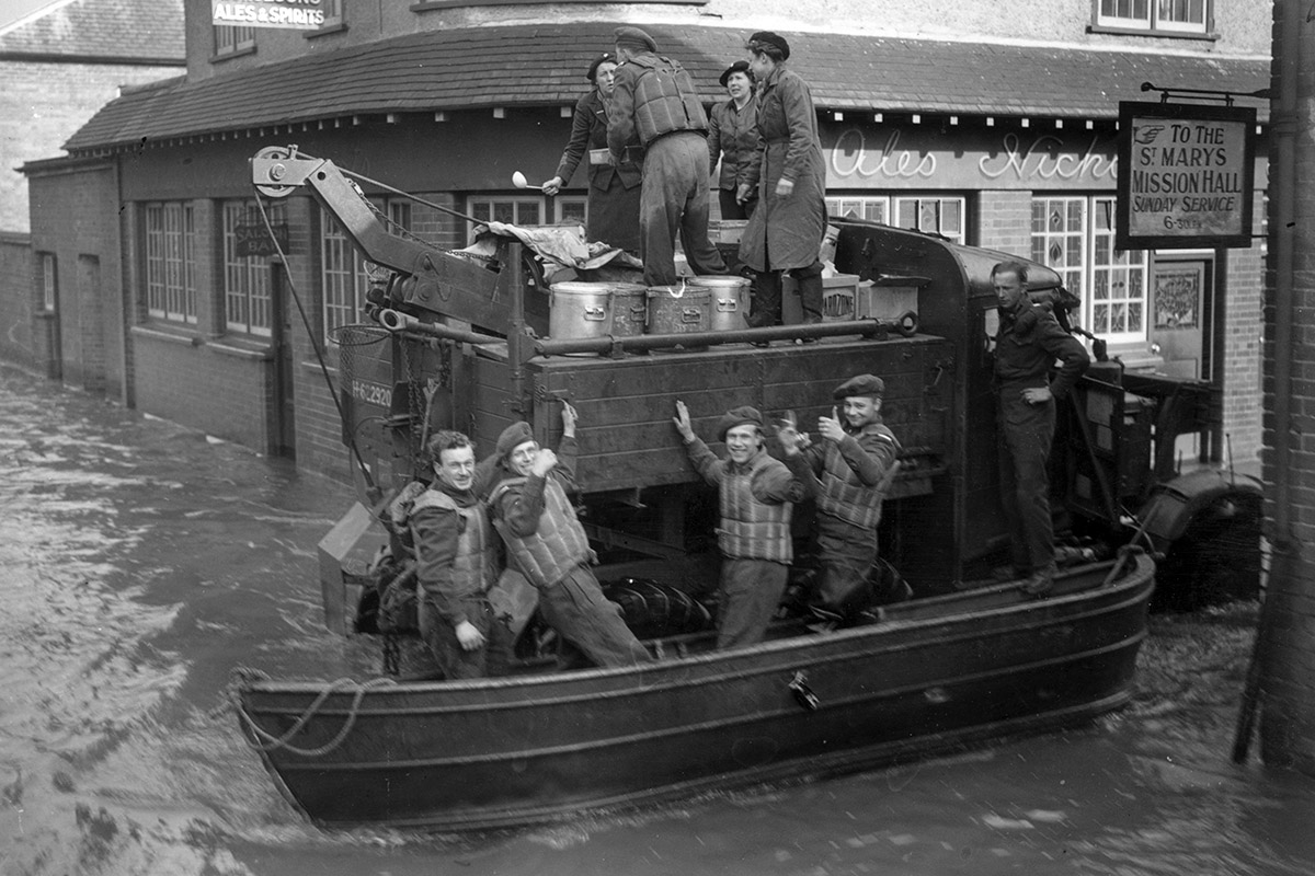
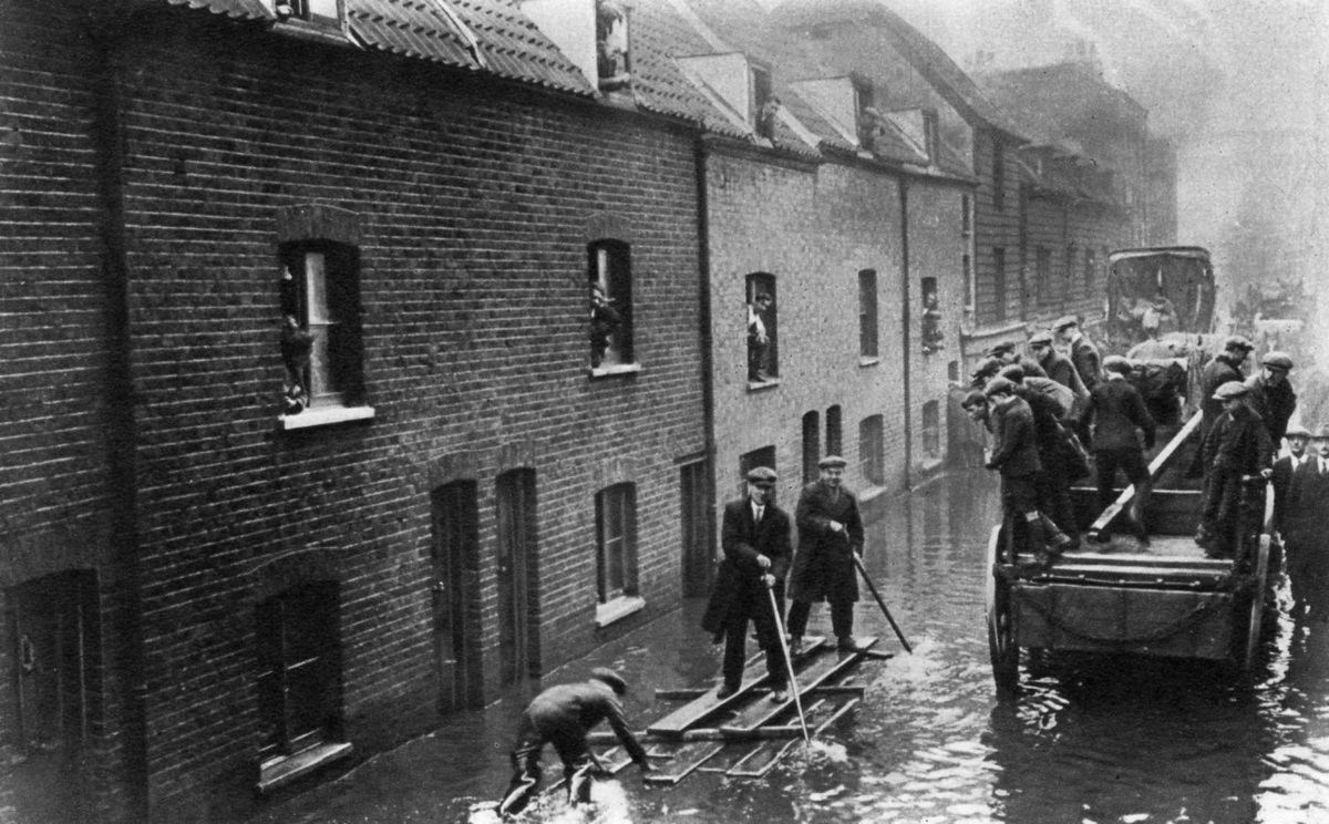
In the 1928 Thames flood, 14 people died. After 300 people died in the UK in the North Sea flood of 1953, the issue gained new prominence. Early proposals for a flood control system were stymied by the need for a large opening in the barrier to allow for vessels from the London docks to pass through, the Thames Barrier was eventually completed in 1982.
Two of my Thames Barrier Studies will be exhibited as part of London: A Sense of Place, in Bankside Gallery 7th October - 5th November.
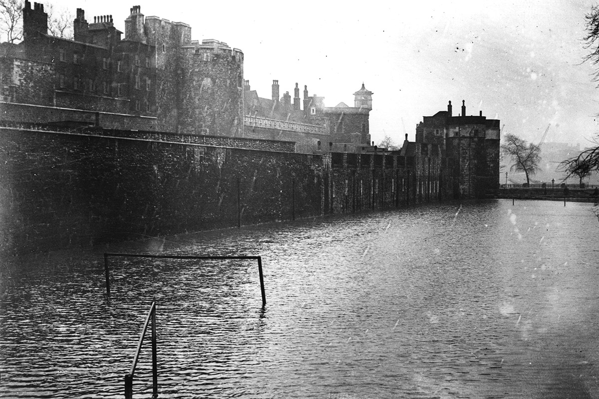
1928 Thames Flood